Directions: From Blairsville Georgia south of Blairsville via U.S. 19/129 enter
the Desoto Falls scenic area
FromCleveland Take US 129 north from Cleveland 15 miles.
enter the Desoto Falls scenic area
From
Dahlonega Hwy. 19 north from Dahlonega for about
18 miles
DeSoto Falls
DeSoto Falls was named for the Spanish
explorer Hernando De Soto because a piece of armor attributed
to his expedition was supposedly found in the area. Located in
rugged mountains with awesome views. Elevations in this 650-acre
area vary between 2,000 and 3,400 feet. Visitors can hike to view
three waterfalls.Upon entering the woods at 750' you'll cross
a footbridge over Frogtown creek. Cross to the west side of the
creek. The trail to the middle and upper falls is on the right
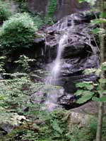
while the lower fall's trail is on the left. Of the three falls
in the area the middle falls is the best. Spilling in four tiers
over granite ledges, the falls fade into the overhanging trees
and mountainside.
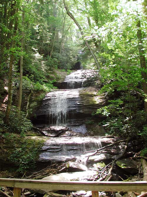
The lower falls trail is quick and easy
and returns to the trail head. The upper falls (seen above) are
the actual DeSoto Falls and are about a mile and a half, total
trip. The ascent is easy, rolling up and down, broken by long
flat stretches in deep wood groves. Occasionally the visible creek
makes a soothing gurgle and the falls themselves are worth the
trip. Just before you reach these falls you cross a bridge, then
turn into the side cove containing the falls. A brief ascent takes
you to the observation deck.
All three falls are on tributaries
to Frogtown Creek. The name Frogtown originated from the Cherokee
myth about a great frog, Walasi, who guarded Blood
Mountain,one of the Cherokee's holy places. The name Walasi-yi
literally means "Place of the Great Frog." The gap above
the falls was known as Frogtown Gap until the Appalachian Trail
was built intersecting the old Indian path, it then became known
as Neel's Gap thereafter.
Fall size: 40'
Beauty Scale:
(1-worth seeing-10 awesome) 4-6
Activities: Camping, picnicking, fishing, hiking.
Facilities: Parking, restrooms, observation decks, Desoto
Falls Recreation Area has toilets and drinking water available. Each
site is equipped with a picnic table, tent pad and grill.
Fees: Area is open from late April until late November.
A fee is required for camping and day use parking. This area is open
24 hours a day for campers useState fishing license and trout stamp required
for fishing
Closest town: Blairsville, Georgia
For more information:
U.S. Forest Service,
Brasstown Ranger District,
1881 GA Highway 515, Blairsville, GA 30512.
Phone (706) 745-6928.