Directions:
From Blairsville Georgia
take US 19 & 129 south for 8 miles.
Turn left (east) onto Georgia 180. Go 9 miles to Georgia 180 Spur and
turn left (north). Go 3 miles to the Brasstown Bald parking area.
From Cleveland Georgia
take GA 75 north through Helen to GA
180; turn left (west) onto GA 180 (also GA 66); go 6 miles; turn right
onto GA 180 spur; continue 3 miles to Brasstown Bald parking lot.
From Hiawassee Georgia
Take US-76 [SR-17] (South-East) 2.8 miles Bear
RIGHT (South) onto SR-17 [SR-75] 6.3 miles
Brasstown Bald Park will be clearly marked on the right >Total
Distance: 9.1 miles
Estimated Time: 12 minutes
hiking, breathtaking views, camping with electric,
sewer, waterhook ups, picnic table and fire grill.
Facilities:
Video show, picnic area, bookstore and gift
shop, hiking trails, parking lot, restrooms, exhibits, observation
deck, brochures, concessions, shuttle bus.
Fees: Parking $3.00 per vehicle
For a fee of $2.00 per person, a shuttle bus
can carry visitors from the parking area to the visitor center, weekends
during April and May then daily from Memorial Day through the end
of October. The short .5-mile paved trail leads from the parking area
to the visitor center on the bald is steep but has many benches to
rest along the way.
Closest town: Hiawassee, Georgia
For more information:
Brasstown Ranger District
1881 Highway 515 P.O.Box 9,
Blairsville, Ga. 30514
Phone: 706-745-6928 Fax:706-745-7494
Visitor center phone (706) 896-2556.
Brasstown Bald Wilderness and Visitor Center

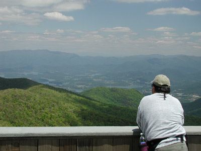
At 4,784 feet, Brasstown Bald is Georgia's highest mountain. From its summit you
can take in breathtaking views of four states. On a clear day, you
may see as far south as Atlanta.
In 1986, 11,823 acres within the Chattahoochee
National Forest were designated by Congress as the Brasstown Wilderness.
Since then, an additional 1,152 acres have been added. The paved trails,
parking areas,and visitor
center of Bald Mountain is not part of the wilderness area and
is only .75 acre.
The mountain is mostly made up of soapstone,
dunite, and olivine. This is the southernmost habitat for many northern
plant and animal species. A northern hardwood of huge, old birches
covers the north face. Rhododendron and mountain laurel are also abundant.
The wildflower displays are particularly nice on the north face coves
and down the east side of Wolfpen, one of the longest, highest ridges
in Georgia.
The trail from the parking area to the summit,
the Wagon Train Trail
is well worth walking. The old wagon train road to Young Harris leads
east then north into the fantastic "cloud forest" of northern
hardwoods on the north side of the mountain, below the visitor center.
The huge, old yellow birch are festooned with old-man's beard lichen
because of the continuous moisture from cloud condensation.
Rosebay rhododendron may be found
near the parking lot, followed by purple rhododendron as the major heath
shrub. As one ascends, the trees gradually get shorter. One soon enters
a dwarfed red oak and white oak forest where the trees are very old,
twisted, and limby. The top is a shrub bald with unique mountaintop
species such as dwarf willow and red-berried mountain ash.

Cherokee History
Cherokee legend described a
horrible, sharp-clawed, winged beast who attempted to steal and eat
Indian children. The Cherokees cleared the forest to capture the monster
and prayed to their Great Spirit, who killed the beast, restored the
children, and has kept the mountaintops clear of trees ever since.
This areas name derived from the Cherokee
word Itse'yi meaning "new green place" or "place
of fresh green." It became Brasstown Bald because of settler's
confusion between the Cherokee words itse-yi and untsaiyi, meaning
"brass."
The Visitor Center Complex

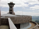
The center, built of stone, offers interpretive
programs tracing human and natural history of the southern Appalachian
region. The Mountaintop Theater features continuous video programs.
An outside observation deck provides a 360-degree view of the surrounding
area. Here visitors may be awed by the view but unprotected from the
wind. Because of its height, Brasstown Bald gets much weather that
misses the valleys. Strong wind, rain, and lower temperatures are
not uncommon. In winter there is often snow and ice. The fire lookout
tower is not open to the public.


